

You must log in or register to comment.
Its there any “android auto” alternative? so i can use it in my car’s screen without google
How many non tech people would use this, especially if not in play store. 95% of people don’t know fdroid exists
My dad uses it. He’s as non-tech as non-tech gets. But I had to install it for him.
Reminder: As long as you don’t get rid of “Google Play Services” running as “root” 24/7, removing/not using Google Maps doesn’t mean so much to Google.
I disagree. It’s a step in the right direction, even if there is still a long distance to go.
Just installed and signed into my OSM account! Been meaning to update more of my area.
I am looking to try moving away from Waze too. Are there any good open projects that have support for reporting cops and the other stuff like Waze? When I was looking last year, I came across Navmii since it does have some level of reporting stuff. However the app itself is very glitchy and I don’t think it is really actively being worked on. Or is popular enough to even know if literally anyone around me is reporting things. When I have tried to report a cop being parked waiting for speeders, it doesn’t show anything even on my map.
They use OSM data which I think is also not being actively scraped, as I personally added my entire street’s addresses and doesn’t show on Navmii (but does show up on the main OSM site and on Organic Maps).
It’s only a matter of time until Google Maps will enshittify, too.
They already have. Have you noticed the number of ads shown on google maps?
And I’ve been increasing given directions like “turn right after paid promotion X, with tagline Y”
Enshittification truly is a shame, because my old school GPS actually does this already (Turn left past the McDonald’s) and while I have no idea whether it’s paid promotion or not on my device, I like that feature. If that feature is equally applied to any known business as a landmark (heck, even other services like police stations, fire stations, etc.) it would be appreciated by users.
Instead, and here we are beating this drum again, capitalism gets its grubby fingers in this pie too and uses it for further advertising, turning a good feature into a bad one.
Oh hell, I have not had that one yet. I am already leaning away from it with just the random pins showing up on my nav that were not searched for.
Just downloaded and installed Organic Maps from F-Droid. Looks really nice.
Google is such a great source of inspiration (^_^)
the biggest problem I have with switching is that Google Maps is a business directory. open street maps is empty where i live. it works okay for navigation, but not so much for finding a coffee.
You can add the POIs and fill the gaps!
there are ways to make it easier; it’s been gamified:
https://github.com/streetcomplete/StreetComplete
Available on FDROID.
When my partner stops to play pokemon go, I complete some Open Street Map info quests…
Street Complete is a great app for quests regarding existing features, but also consider the feature might not exist at all yet in OSM.
Map Complete is great for adding new features. It also asks a bunch of optional simple questions about the feature which gets converted into the relevant OSM tags. It’s browser based but you can just add a shortcut to your home screen to have it quickly accessible.
I’ve just installed this now, thanks for the tip!
So many quests right on my street!
As many have already told you, you can contribute to OSM, I have put in it almost all the establishments in my area (Not at Big area but…). Although soon I have to update them
im on board with the idea in general, but im not going to do this. it would be an endless effort to the benefit of almost nobody. places go up and down so fast here that google maps is often out of date too. it’s filled with stale information and im flagging missing places constantly. every digital community in this country is a garbage pile.
the ride share apps here do use open street maps though, and im making corrections to building addresses when i find something isn’t right. it’s great.
Umm…it benefits loads of people.
On OSM you don’t have to just flag something. You can edit it directly, so it leads to more accurate information.
But you can also just flag it if editing is not your cup of tea. Here’s a convenient, non-techy tool to add notes for others to use when editing: https://www.onosm.org/
Great point
I felt the same however Organic Maps did have many businesses. And with Street Complete I can correct any errors when I visit.
It may simply be my area, but I so recommend organic maps over Osmand for business and POI lookups
You can contribute them!
There’s a pretty barebones editor in Organic Maps, but you can also check out Street Complete and Every door (more advanced and less user friendly, though insanely efficient)
I use Vespucci, it’s advanced but still pretty easy if you just want to do basic editing. https://vespucci.io/
P.s. how do you link to an app on fdroid?
Be the change your want to see in the world https://droidify.eu.org/app/?id=de.westnordost.streetcomplete&repo_address=https://f-droid.org/archive
It says “page not found”, maybe because I’m not in EU.
Very strange. It doesn’t work. I shared directly from the f-droid client droid-ify
https://f-droid.org/en/packages/de.westnordost.streetcomplete/index.html
Same in EU
I’m in the US, also says page not found for me.
Yea looks like they were linking to this: Street Complete
Link to fdroid next time
Oh weird. That’s shared from droid-ify which is an f-droid client.
Here’s the proper link https://f-droid.org/en/packages/de.westnordost.streetcomplete/index.html
Same issue here. I really like their maps in general, but my local area in OSM is about a decade out of date
Yeah, it’s interesting to look through the edit history over the years. With StreetComplete I recently fixed ~8 stores that were many years out of date, during an hour walk.
It’s fun to find a real hole-in-the-wall that even google maps doesn’t have.
That kind of contribution seems like a lower level of effort than making changes to source code.
And there are apps that make it very very easy and fun. Check out street complete.
I keep businesses in my area up-to-date, doesn’t take much time at all.
Yeah trying to find anything on any of the competing apps is basically impossible. I mean ffs OSMand literally couldn’t do address lookup!
I just recently learned this.
For OsmAnd, go to search, then the categories tab, and then hit “Online Search”.
Voila, address lookup.
I have found Organic Map’s search to be far better than OSMand. OSMand has far more features though.
i think openstreetmaps only works in big countries honestly
What does the size of the country have to do with it? Which good big and bad small countries are you talking about?
Most people don’t use openstreetmaps on these small countries like with low/medium population it feels like apple maps on there
Can you give an example? Because I’ve just looked at Luxembourg, Nepal, and Aruba, and they’re all littered with named buildings and landmarks. Pyongyang even has a fair bit filled in.
didnt rlly try it but might try tbh but idk since i see people here where i live use google maps
edit: tried it and it really is quite outdated my house does not show up and idk if waze is even privacy respecting
Waze is google these days. They bought it some time ago.
Ohh
All it takes is you to fix this. Its even easier in a small country
oh okay
Based and dank
You seem pretty active with OSM, so I’ll propose this here since I don’t have time to make it.
OSM is very, very popular with hikers and cyclists, and I’d argue rhey drive a lot of it’s use, especially via third-party systems. However, it’s one failing is “gravel” roads. While they support many different gravel road types, they admit on their Wiki that use of the proper terms is low.
Given the heavy use of Garmin devices, especially among gravel cyclists, mountain bikers, and bikepackers, where terrain definition is important, it would be outstanding to have an app in the Garmin store for Edge devices that could report the exact terrain type (compacted, dirt, etc) with a button mash as you ride it.
Check out StreetComplete (https://play.google.com/store/apps/details?id=de.westnordost.streetcomplete)
It does more than just road surface type, and incorporates location-based OSM editing in a very user-friendly way!
F-Droid link: StreetComplete (OpenStreetMap surveyor app) https://f-droid.org/packages/de.westnordost.streetcomplete/
Yea, I’ve used that, but it’s a phone app. Riders need a one-touch solution on Garmin (or other bike computers, but Garmin dominates the market right now).
It also doesn’t seem to let you edit anything more then a mile away from your physical location. I get that they want accuracy but it’s preventing me from editing incorrect information to a place I have just been.
I will add as a narrowboater.
I found towpaths also have this issue with definition of surface.
I am legally blind. (Some vision but bad)
I have a few times tried to add more ditail to areas of towpath that will help the others like me know what to expect before mooring.
Seems anything that improves this will help in your issues as well.
OrganicMaps is amazing. Strong recommend to everyone. I only recently found out about it.
Any details on why it’s amazing? What does it do or doesn’t?
It shows me where the speed cameras are :)
- It has the map corpus from OpenStreetMap, so one of the best in the world
- It works offline - just download the desired maps onto the device
- That makes it really, really fast. Google Maps is slower
- You can also use it in areas with bad reception. I’m using it for hiking in the woods where there is no cell phone connection available
- I really like the UI - they are f.e. better at displaying house numbers and street names than Google.
- No ads
On the hiking note, it also shows a lot of trails. I used it to navigate to a trail head and was pleasantly surprised to see a rough outline of the trails I would be using plus some others I didn’t know were there.
It even has water markers for longer trails where youd be hiking for weeks or months at a time. Sometimes those spots are dry, but you can clearly see water channels in the ground where it would be flowing.
Google’s maps are decent and can also be downloaded to be offline…? But yeah, it seems like it’s a nice alternative, especially if you want to be free from Google’s grips.
Maybe it’s iOS specific but I had to go to a region and download the map to be able to search it, which is not great
Same, I have recently installed LineageOS on my phone and was looking for various replacements for Goggle apps. What I really like about OrganicMaps is that it downloads the maps locally, so you can view it even if you aren’t connected to the internet.
google maps can do that too though
IIRC At one point Google Maps would let you download a map for browsing, but you couldn’t do offline navigation. Don’t know if that’s still the case.
Organic Maps does the routing on the device.
it’s had offline navigation for years now
Thanks, I wasn’t aware of that. I should have really had this information a year ago when I was constantly screenshotting Google Maps, LOL.
The feature looks made ugly on purpose though (compared to organic maps where you can just download the whole country or select more precisely what you want)
All of you are invited on !openstreetmap@lemmy.ml
Also checkout the many editing tools, such as https://mapcomplete.org, htpps://streetcomplete.app,…
I successfully used Every Door during my holidays to contribute
Every Door
thank you for sharing, definitely the easiest for Android from my research :-)
Note: there is a comparison of editor apps here: https://wiki.openstreetmap.org/wiki/Comparison_of_editorsThere’s a small learning curve I wish some bothered to understand first. Does this app help? The part of this I don’t like is vacationers leaving useless names like ‘Mango lady’, ‘many street vendors’ for a block, or ‘local restaurant’ since they can’t read the sign as opposed marking up the cuisine type, maybe adding an English description, & leaving the name blank. Nobody expects uploads to be perfect but Bangkok is littered with this noise that makes it hard to follow or find things.
It takes effort and knowledge to make good contributions, this app is just a tool to do that.
I can only say I myself try to make valuable contributions, some other people might care less.
I think EveryDoor requires some relatively deep understanding of OSM before actually being a useful tool. So edits like this should be rare with that tool. Many of the edits like this are from when MapsMe was very popular and suddenly introduced editing, without enough nuance in the process. Bad edits do happen everywhere, you need a good balance between people who data curation and newbies making beginner mistakes. In some places, there’s a lack of experienced people maintaining the data.
Thank you for sharing the links!
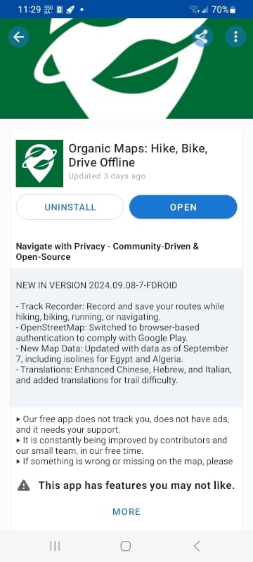
Organic Maps is available on F-Droid.
Do you have to add a Repo? I can’t find it…
You might have to enable showing apps with other anti-features in f-droid settings.
That fixed it. Thanks!!
I didn’t even know this was a thing. This worked for me.
I’m showing it from a basic search. Are you using a fork of F-Droid?
Nope. Not a fork. Someone else posted the link to the F-droid issue bug.
You have to go into settings-> app compatibility-> anti-features -> check the “other anti-features” box.
Organic Maps was put back onto the Play Store the next day day: https://organicmaps.app/news/2024-08-18/good-news-organic-maps-appeared-again-in-the-google-play-store/
Yeah but it demonstrates googles unwillingness to cooperate and give fair warnings.
I didn’t know about Organic-Maps. I used Osmand, which has a subscription fee for downloading maps.
Thx!
I use both OrganicMaps and OsmAnd. I find that OsmAnd is better for poweruser functions (like editing the map or recording a track), but OrganicMaps is a very simple navigation app that just works.
I didn’t have to pay for it, installed from F-Droid, and I can download any map I’ve tried so far. When I’m traveling I like to pre-download the standard map for the whole state if it’s one I don’t already have installed. It’s nice to not have to worry about data / reception.
Overall OsmAnd is a pretty good GPS-map-navigation app, but has several annoyances and bugs. Still better than using Google’s app to me. I need to check out Organic maps too
Also nice to download all the Wikipedia data for the area, so you can read about places you visit…again, all without data.
Cool, I didn’t know you could do that
Osmand saved my ass multiple times hiking in very remote locations. Absolutely worth the subscription!
Anything that keeps maps in local storage so you can use GPS while offline is somewhere between very helpful and lifesaving. Sounds like Osmand is in there.
Organic Maps lets you download also. I got it specifically for backpacking because it enabled that. It certainly has been worth the $0. I should probably donate something each trip.
Definetly one of the subscriptions I don’t regret as much as others but still a steep cost for my frequency of usage. I need it approx 6 weeks per year and only as backup when traveling/hiking.
A free alternative (simply Osm) is much appreciated.
The pro version of OsmAnd is free on fdroid!
Subscription fee? Is that a new thing? I’ve only been using OsmAnd from F-Droid, but I’ve been downloading maps for offline use without any subscription: https://f-droid.org/en/packages/net.osmand.plus/
I use FDroid, but OSMand from the play store has the subscription.


